
Where Is the ISS Now? How to Read Its Ground Track
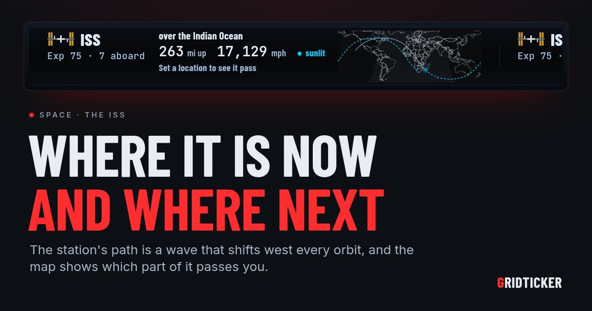
Where is the ISS now? No article can tell you, because by the time you finish reading this sentence, the International Space Station has moved several miles. It orbits about 250 miles up at roughly 17,500 miles an hour and goes all the way around the Earth in about an hour and a half. What you need is a live map, and the skill to read one. This piece covers the second part: why the station's path looks the way it does on a map, why it never goes over the same place twice in a row, and how to tell from the map whether it is about to come over you.
Why "now" changes so fast
At about five miles a second, the station crosses the continental United States in roughly ten minutes. Any position you look up is already out of date a minute later. That is why a static answer ("it's over the Pacific") doesn't help much. A live map that keeps moving tells you more, and so does knowing where the station is headed next.
Reading the ground track
The line a tracker draws under the station is its ground track: the point on Earth directly below it, traced over time. A few features of that line confuse people the first time they see one.
Why the path is a wave
The station's orbit is a flat circle, tilted about 51.6 degrees to the equator. Spread a tilted circle onto a flat world map and it becomes a wave. The station climbs toward about 51.6 degrees north, turns, and drops toward about 51.6 degrees south, crossing the equator twice on every orbit.
That tilt also sets where the station can ever be. It never passes directly over places much farther north or south than about 52 degrees. Most of the United States, Europe south of Scandinavia and most of the populated world sit inside that band, and that is why so many people get to see it.
Why each orbit lands farther west
The Earth keeps turning underneath the station while the station goes around. In the hour and a half one orbit takes, the planet turns about 22 to 23 degrees of longitude to the east. So each new wave on the map starts that far to the west of the last one. Watch a tracker for an afternoon and the waves walk steadily across the map.
That shift explains something people notice: the station can pass near you on two or three orbits in a row, each a little lower in your sky, and then not come near you again for hours.
Day side and night side
A good map shades the half of the world where it is night. That shading matters more than anything else on the map if you want to see the station yourself.
When "over you" means you can see it
The station has no lights bright enough to see from the ground. What you see is sunlight bouncing off it. So two things have to be true at once: the station has to be in sunlight, and your own sky has to be dark. That happens around dusk and dawn, when the ground is in shadow but the station, 250 miles up, still catches the sun.
On the map, that means the station is on the day side, or just past the line into night, while you are on the night side close to the line. In the middle of the night, the station is usually in the Earth's shadow and invisible even when it passes straight overhead.
Visible passes come in runs. For a week or two you may get evening passes, then a stretch with none, then morning passes. Low passes skim the horizon and are easy to lose behind trees and buildings. High ones climb well up the sky and are much easier to catch.
The other station: Tiangong
The ISS is no longer the only crewed station up there. China's Tiangong orbits lower and on a different tilt, so its ground track is a different wave on the same map. The same rule applies: you see it when it is in sunlight and your sky is dark. It is worth following both if you like going outside to look.
A quick checklist for reading any ISS map
- Find the station's dot, then the line ahead of it. Where it's going matters more than where it is.
- Look at the shading. Is the station near the edge between day and night?
- Find yourself. Is the next part of the track close to you?
- Check the time. A pass near you at dusk or dawn is worth going outside for. One at 2 AM usually isn't.
How GridTicker shows where the ISS is now
GridTicker is a live ticker that runs in a browser on a spare screen, a second monitor or a TV. Space is one of its sections, and the ISS has a card of its own. The guide explains everything the card shows.
- Where it is right now. The card says what the space station is over right now, how high and how fast it is going, whether it is in sunlight, and who is aboard.
- The map, already read for you. The map shows the whole world with the night side shaded, where the station has been in the last 45 minutes, and the dashed line where it is going next. The station moves along that line second by second, and your place is the ringed dot.
- The next pass. The bottom line of the card is the next time the station can be seen from your place.
- A heads-up before it arrives. Five minutes before the station comes into view, the screen says so, with a countdown and which way to face. While it is up, the screen draws a sky: the horizon as a circle, with straight up at its middle, the station where it is now, and how high to look in degrees and in fists held at arm's length.
A few settings on the Space page shape this:
- Where you watch the sky from. Type an airport code or use your browser's location. With nothing set there, it uses your Flights location, and failing that your first weather place.
- Passes that climb at least. Count every pass above 10 degrees, or only those that clear the trees (20), a third of the way up (30), or high passes only (40).
- Tiangong too. The ISS and China's Tiangong are each their own feed under Space feeds, switched on for the screens you choose.
- Alerts. Each alert can be switched off on its own if you'd rather just have the card.
It runs in any modern browser, on Windows, macOS, Linux or a Raspberry Pi, with nothing to install. To keep the station moving across a screen in your house, set up a strip at app.gridticker.com/signup.